Exporting Data
TestFit allows for several methods of exporting data
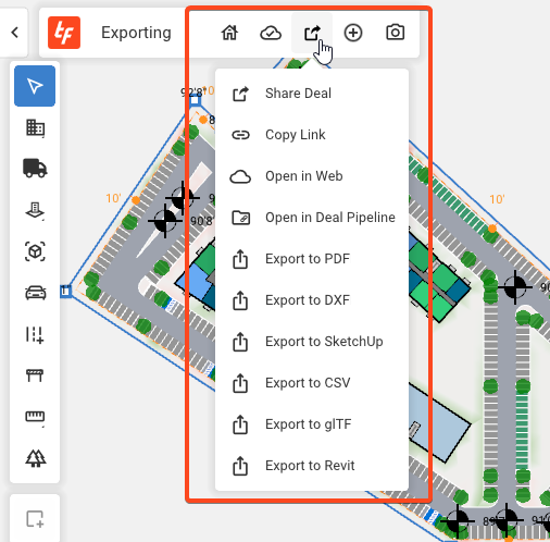
From the Export/Share dropdown you will find the following export options:


- .pdf - existing model is out to floor plans in a pdf. This option launches a dialogue box for preferred PDF settings (like paper size and scale).
- .dxf - the currently selected site with currently selected floor plan will be saved out to a layered DXF. The DXF file format (similar to .dwg) is most commonly used in CAD software like Autocad.
- If geolocate DXF export (WGS84) is turned on in TestFit > Preferences, the exported file will be in WGS84 latitude and longitude coordinates. Otherwise it will use the file coordinate system and units of measurement.
- .skp (SketchUp) - existing massing model from 3d view will be saved to a sketchup file. Each stacked building element exports as a component. Individual buildings export as model groups.
- .csv - tabular data is saved to a .csv format (for import to excel)
- .glTF - saves the 3d modelview
- tfrvt (REVIT) - A .tfrvt is generated for import into Revit. The entire deal will be exported and you'll need to select the site/scheme once in Revit. Details in the Importing TestFit into Revit knowledge Base article
Data Layers (Topo lines/Wet lands/Flood Zones/Parcel info) does not export from the TestFit Deal
